Throwback Thursday | When Arroyo Seco Parkway Became “Arroyo Speedway”

The Arroyo Seco Parkway was designed as a parklike thoroughfare for motorists cruising at a leisurely pace

PHOTO: Pasadena Museum of History | SouthPasadenan.com News | The Arroyo Seco Parkway at Fair Oaks Avenue shortly after construction, South Pasadena (1940)

The Arroyo Seco Parkway was opened on December 30, 1940, becoming the first nonstop “freeway” west of the Mississippi. The highway’s original “sunken garden” design drew inspiration from the East-coast parkways.

PHOTO: USC Libraries | SouthPasadenan.com News | Arroyo Seco Parkway motorist Elmer Crumley stands beside his overturned car near the Avenue 43 exit (1951)

As vehicle technology improved, speeding motorists became more common on all public roads and highways. The parkway’s many off-camber curves and short ramps made it increasingly difficult to navigate.

PHOTO: Rick Thomas | SouthPasadenan.com News | Chevy Coupe front end damaged from a collision on the Arroyo Seco Parkway, South Pasadena (1942)
PHOTO: Rick Thomas | SouthPasadenan.com News | Repair garage on Fair Oaks Avenue near Mission Street – one of many that sprung up along Route 66 in town, and after the Arroyo Seco Parkway sliced through South Pas (1942)

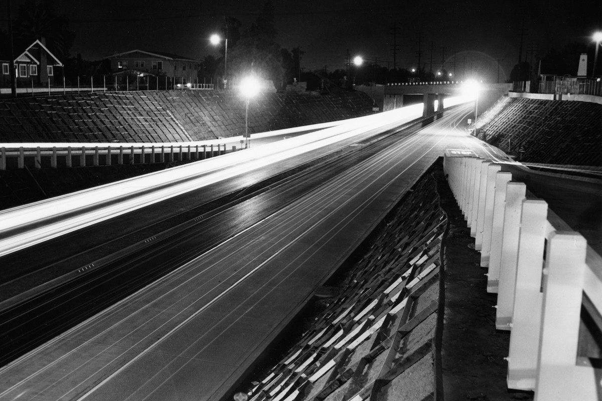
The Arroyo Seco Parkway had no retaining center divider, only two concrete lanes with a third inner asphalt lane in each direction, stop-and-go on/off ramps (some marked 5 mph), and a maximum speed limit of 45 mph. Then came rocket-inspired, 8-cylinder gas guzzling heavy metal!

- Advertisement -

Automobile traffic speeds increased to well over 55 mph, and our sunken garden parkway soon suffered from lack of maintenance receiving a name change to Pasadena Freeway (speedster motorists referring to it as “Arroyo Speedway”).

PHOTO: South Pasadena Police Department | SouthPasadenan.com News | This vehicle exiting the “Arroyo Speedway” at Fair Oaks Avenue ended in a fatality, South Pasadena (1952)

The infamous Fair Oaks off-ramp at South Pasadena closed due to frequent collisions from vehicles traveling at high speed on the “Raymond Hill curve.” The Fair Oaks exit was relocated further up the Arroyo Seco Parkway (before the Raymond Hill curve) and permanently rerouted on surface streets.

Today, the CHP seldom patrols this dangerous stretch of the highway due to its many curves and short ramps, making it challenging to track speeding motorists and pull them over safely. And on most late nights, the high-pitched buzz of sport bikes and speeding drivers still fills the Arroyo Seco.


Rick Thomas
Author Rick Thomas is the former museum curator and vice-chair of education for the South Pasadena Preservation Foundation. He served on the South Pasadena Natural Resources Commission, helping to maintain a strict policy protecting the city’s great old-growth trees. Using touchstone photographs from his own collection—one of the San Gabriel Valley’s largest accumulations of historical images and artifacts—as well as national, state, and local historical archives, Thomas provides a window to his city’s past and an understanding of why its preservation is so important.