















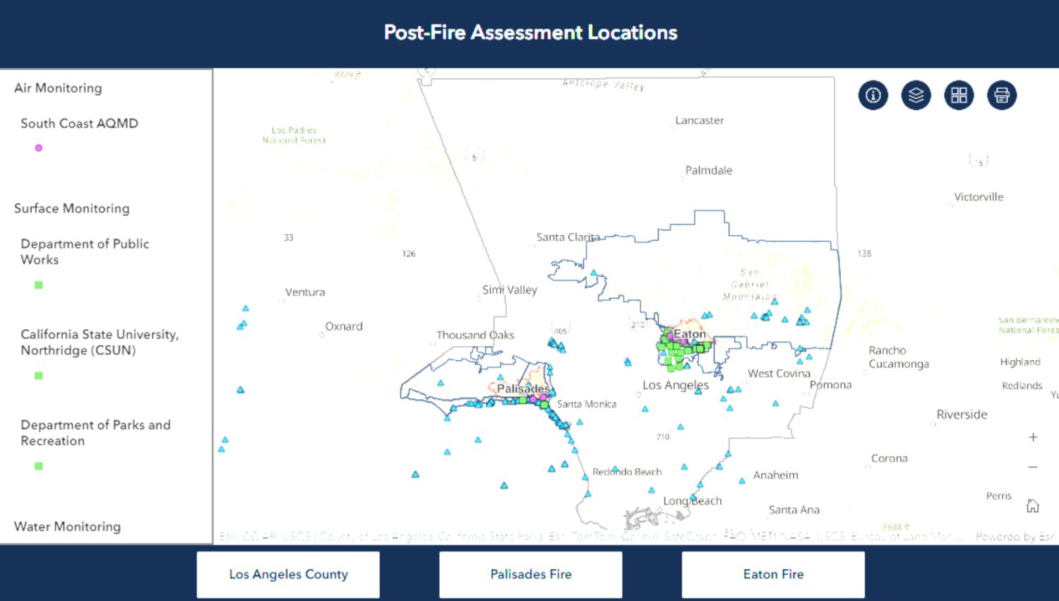

The Los Angeles County Department of Public Health has launched a new interactive online dashboard to provide residents with access to environmental and health monitoring data in the wake of the January 2025 wildfires. Developed in collaboration with regional and state agencies, the tool supports a transparent, coordinated post-fire response.
Four Key Focus Areas of Monitoring
The dashboard offers a visual overview of monitoring sites across Los Angeles County, with assessments focused on air, surface, water, and human health impacts. Although the current map includes many primary locations, it does not yet reflect mobile monitoring routes. Additional data and locations will be integrated as they become available.
Air Quality
Air monitoring evaluates both indoor and outdoor environments to detect pollutants that could impact respiratory health—particularly important for vulnerable populations.
Surface Contamination
Surface assessments include testing of soil, indoor areas, coastal sands, and wildfire debris such as ash and soot to determine potential exposure risks.
Water Safety
Water monitoring focuses on coastal and freshwater sources, including pools, to detect wildfire-related contamination that could pose health hazards.
Human Health Impact
Residents in affected areas are offered voluntary blood lead testing, with a focus on children and high-risk groups, to identify potential toxic exposure.
Supporting Public Health Through Transparency
The launch of the dashboard reflects L.A. County’s commitment to public engagement, transparency, and informed decision-making. The tool aims to empower residents with science-based data and support recovery across wildfire-impacted communities.
As the region continues to recover, the data collected will inform ongoing public health recommendations and contribute to long-term environmental and community resilience strategies.