


Created and written by South Pasadena resident, Scott Astle
With the spike in COVID-19 cases we seem relegated to staying at home and entertaining ourselves. Unlike the previous stay-at-home orders, we are still encouraged to get out and exercise as long as we wear masks and maintain social distancing. Since hiking is something we can still do, Scott Astle has shared a hike he created through the hills of South Pasadena.
He was inspired by the “Secret Stairs” hikes that Charles Fleming included in his books. He heard him speak at the South Pasadena Public Library and since his book had no hikes in South Pasadena, he thought he would create one.
The hike is just under five miles through the hills of South Pasadena and starts on the west side of town. You can begin and end at any point along the hike. Scott has enjoyed this hike and hope that you will too.
- I start the hike at the intersection of Brunswick and Monterey Road. Go up steep hill on Brunswick. There is a story that the dancer Isadora Duncan stayed in one of these houses. When Brunswick reaches St. Albans veer to the right and take St. Albans up to the top. At Camino del Sol turn left and head downhill.
- Stay on Camino del Sol until it gets to the bottom of the hill at Camino del Rey. At Camino del Rey, turn left.
- As you walk along you will pass Monterey Hills Elementary School on your right. After the school it would be good to cross Via del Rey and continue up the hill until Flores de Oro and turn right. One block later turn right onto Camino Lindo. Continue until you get to Alpha Avenue. Turn left onto Alpha Avenue. This street takes you to the southern border of South Pasadena.
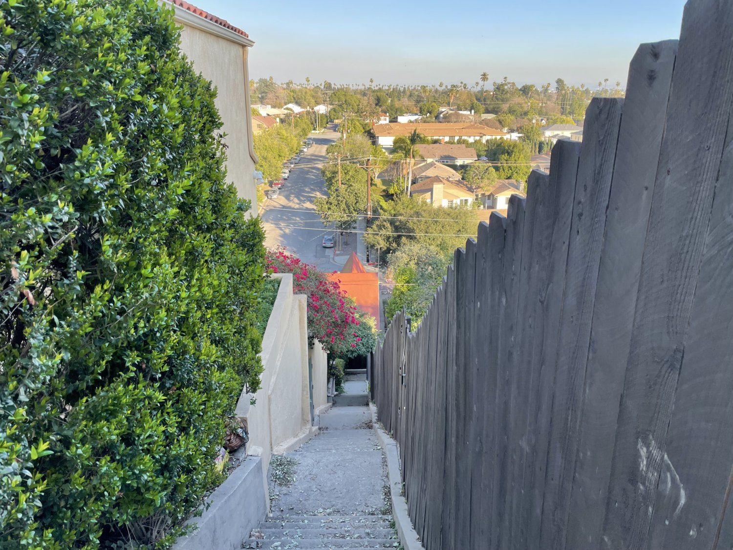
- When you get to Valley View Road, turn left. Valley View is interrupted at Berkshire so go left at Berkshire and then right again on the continuation of Valley View until you get to Meridian Avenue. On Meridian turn left and head North. Past Bonita about where Maple Street comes in from your right you will get to a set of stairs. These stairs are hard to notice so you will have to watch carefully. Climb the stairs.

PHOTO Scott Astle | South Pasadenancom News | An urban hike created by Scott Astle in Monterey Hills of South Pasadena - At the top of the stairs, turn right on Bonita and walk until Bonita and Oneonta split. Proceed onto one way Oneonta going opposite any traffic. In walking along, be careful as there are not always sidewalks so you walk in the street.
- Stay on Oneonta until it ends at Summit Drive. At Summit turn right and go downhill for a block and then turn left on Gillette Crescent. Follow Gillette Crescent down to Meridian where you will turn left.
- Continue on Meridian behind the High School until you get to Rollin. At Rollin turn left and go uphill to the end of the street.

PHOTO Scott Astle | South Pasadenancom News | An urban hike created by Scott Astle in Monterey Hills of South Pasadena - At the end of Rollin look for a South Pasadena Parks sign. This is the beginning of the Snake Trail. Enter the trees and follow the path as it cuts back and forth and ends up on Flores de Oro.
- Turn right on Flores de Oro and take it up to Via del Rey. Here at Via del Rey turn right and go up to the top of the hill. At the top of the hill La Portada will come in from the left. Cross Via del Rey and turn left up La Portada until you get to the South Pasadena water tower. There is a circle here which is one-way going counter clockwise. As you are a pedestrian you can go either direction around this short circle and then continue on Alta Vista.
- There will be some roads branching off of Alta Vista like Indiana but stay on Alta Vista. At one point Alta Vista becomes St. Albans and there is a sign to indicate this change but there is no intersection or other indication that you are now on a new road. Turn left onto Blair and follow it until it ends at a cul de sac. At the far side walk onto a dirt path. Follow the dirt path until it ends in a set of stairs made out of railroad ties. There are not very many of them but they are not in the best shape so be careful.
- The steps come out on Warwick. Turn right on Warwick for a few yards and then turn right again on St. Albans. When you get to Brunswick turn left and go down the hill to the place you started.


If you have questions or would like additional information you can email him at [email protected].


