















South Pasadena, Thursday, Aug. 27, 2026
Rain fell on South Pasadena Thursday afternoon with the thermometer reading 97 degrees in the shade, an odd pairing that traces back to a dying tropical storm a thousand miles away and a heat dome that refuses to leave.
Where The Rain Is Coming From
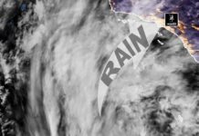
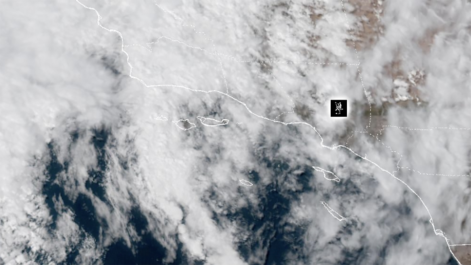
The moisture is what is left of Tropical Storm Iselle, which spun up off the coast of Baja California earlier this week and is now weakening as it drifts west into the open Pacific. The storm’s center never approached Southern California. Instead, an upper-level trough digging down the California coast is scooping a ribbon of Iselle’s tropical moisture and dragging it north over the state through Friday, according to the National Weather Service.
A second source is feeding the same pattern: a cluster of thunderstorms pushing north out of northwestern Mexico with the late-summer monsoon flow. Together they have put enough moisture over the Los Angeles basin for scattered showers, large-drop rain, and isolated thunderstorms, with a small chance of a heavier downpour.
The same storm is responsible for the surf. Southerly swells from Iselle and former Tropical Storm Julio are producing elevated surf and dangerous rip currents along south-facing Los Angeles County beaches, and a beach hazards statement runs through 11 p.m. Thursday.
Hot Weather Ramped-Up
The heat is a separate system. A large high-pressure ridge has been parked over the Southwest all week, and it is that ridge, not the tropical moisture, that has pushed inland valleys past 100 degrees. The tropical air layered on top adds humidity, which is why the heat feels heavier than the number on the thermometer and why overnight lows are staying in the 70s. Forecasters expect many records for warmest overnight low temperatures to be tied or broken Thursday and Friday.

This is not an El Nino event. It is a common late-August setup in Southern California: monsoon moisture plus the remnant of an Eastern Pacific storm riding into a heat wave. The same mechanism brought Tropical Storm Mario’s moisture into the Southland last September, and in its extreme form produced Tropical Storm Hilary in August 2023.
LA County Heat Warning In Effect
The Extreme Heat Warning covering the Los Angeles basin and San Gabriel Valley remains in effect until 8 p.m. Friday. Forecasters describe the risk of heat illness as high for most people, and especially for children, seniors, and anyone without air conditioning or working outdoors.
Overnight lows are running 5 to 10 degrees above normal, which limits the usual nighttime relief. A Red Flag Warning is also in place for foothill and mountain communities through 3 p.m. Friday because of the heat and wind.
Thursday is expected to be the peak of the heat wave. Downtown Los Angeles was forecast to reach about 99 degrees, with inland valleys running into the low 100s.
72-Hour Forecast For South Pasadena
Thursday, Aug. 27: Mostly cloudy and hot. High near 95, low near 73. Slight chance of showers or a thunderstorm through the evening.
Friday, Aug. 28: Mostly sunny and hot. High near 93, low near 72. Slight chance of a shower. Heat Warning expires at 8 p.m.
Saturday, Aug. 29: Sunny. High near 91, low near 68. Dry, with cooling underway.
Sunday, Aug. 30: Sunny. High near 86, low near 65. Onshore flow returns and temperatures settle back toward seasonal norms.
Relief arrives when a large trough moves over the West Coast Sunday and Monday, shoving the high-pressure ridge east and restoring the onshore flow. Temperatures could dip below normal by early next week, with highs in the low to mid 80s and the marine layer returning to the coast and some valleys. A slight chance of rain returns Tuesday and Wednesday.
Staying Safe
The Weather Service recommends limiting outdoor activity during afternoon hours, seeking air-conditioned spaces, staying hydrated, checking on elderly neighbors, and never leaving children or pets in parked cars. Drivers should expect slick roads if showers pass through, since light rain on dry pavement lifts oil to the surface.