



















South Pasadena Forecast, Saturday, Oct. 10 Through Saturday, Oct. 17
Two days after an Extreme Heat Warning expired, South Pasadena is about to get rained on. Showers arrive late Saturday night. Sunday and Monday are wet, and Monday’s high is 65. Then the switch flips again: sunny Tuesday, 90 by Friday, with Santa Ana winds in the conversation.
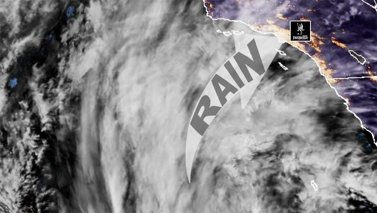
The moisture belongs to Rachel, a former Category 3 hurricane that is now a 60 mph tropical storm racing northeast. Its center is forecast to come ashore just south of the U.S.-Mexico border Saturday night, well south of Los Angeles County. No tropical storm watch or warning covers LA County. What we get is Rachel’s moisture, followed by a much colder storm dropping down the coast Sunday night.
Weather Report South Pasadena/Pasadena At A Glance
Saturday: Morning fog, then cloudy and muggy. High 83. Dry for most of the day.
Saturday Night: Showers move in, mainly after 11 p.m. Low 64.
Sunday: The wettest stretch. Showers, mainly before 11 a.m. High 72.
Monday: Showers and cold. High 65.
Tuesday: Clearing and sunny. High 71.
Wednesday: Sunny. High 78.
Thursday: Sunny. High 85.
Friday: Sunny. High 90. Offshore winds possible.
Saturday, Oct. 17: Warm and dry is the lean. No official number yet.
Rain Total: A quarter inch to 1 inch for Sunday and Monday combined, according to the National Weather Service. More in the mountains, especially the eastern San Gabriels.
The Day By Day
Saturday, Oct. 10
Patchy fog before 11 a.m., then cloudy. High near 83. Light wind turning southwest 5 to 10 mph in the afternoon. Tropical moisture builds through the day, so it will feel sticky. Late Friday the NWS added a slight chance of a stray shower or thunderstorm by afternoon for everything south of Point Conception. Daytime events are in good shape. Late-night events run into the rain.

Saturday Night
Showers likely, mainly after 11 p.m. Chance of rain 70 percent. Low around 64. A tenth to a quarter inch possible.
Sunday, Oct. 11
Showers, mainly before 11 a.m. Chance of rain 80 percent. High near 72. South-southwest wind around 10 mph, gusts to 15. A quarter to half an inch possible during the day. The NWS puts the best rain window from early Sunday morning into early afternoon, with a 5 to 10 percent chance of a thunderstorm over eastern LA County. Breezy, but below advisory levels. Morning outdoor plans need a backup.
Sunday Night
Showers, mainly after 11 p.m., as the second and colder storm arrives. Chance of rain 80 percent. Low around 54. South wind 5 to 15 mph, gusts to 20. Another tenth to a quarter inch possible.
Monday, Oct. 12
Showers. Chance of rain 80 percent. High near 65. The NWS expects some of the coolest temperatures the region has seen in quite some time. Rain from this second system looks fairly light, with a 5 to 10 percent chance of a thunderstorm anywhere. The mountains could see advisory-level wind gusts early Monday. Showers taper Monday night, a 50 percent chance, mainly before 11 p.m. Low around 49.
Tuesday, Oct. 13
Sunny in the NWS point forecast. High near 71. The forecasters’ discussion still allows for a light leftover shower. Low around 51.
Wednesday, Oct. 14
Sunny. High near 78. Low around 56.
Thursday, Oct. 15
Sunny. High near 85. Low around 61.
Friday, Oct. 16
Sunny. High near 90. High pressure builds in and winds turn offshore. The NWS says the most likely result is a weak to moderate Santa Ana wind event, with a wide range of possible outcomes.
Saturday, Oct. 17
This day sits just past the edge of the NWS seven-day forecast, which ends Friday. The trend is warm and dry. The NWS expects the warm-up and offshore flow to carry into the weekend, and the Climate Prediction Center’s forecast for Oct. 14 to 18 favors above-normal temperatures along the West Coast. Plan for a warm day and check back midweek for a number.
Hurricane Rachel Update
As of 2 a.m. Saturday, the National Hurricane Center placed Rachel about 640 miles south-southwest of San Diego, with top winds of 60 mph, moving northeast at 22 mph. The storm strengthened overnight. It was at 45 mph at 8 p.m. Friday.
A Tropical Storm Watch covers the Southern California coast from the Mexican border north to the San Diego and Orange County line. Tropical Storm Warnings are posted for northern Baja California.
The NHC’s odds of sustained tropical-storm-force wind, 39 mph or stronger, stand at 18 percent in San Diego. The Los Angeles area dropped off the NHC’s table overnight. That table lists only places with odds of 3 percent or higher. Friday evening, Long Beach and Los Angeles were at 4 percent.
Rachel’s wind field is growing. Tropical-storm-force winds now reach up to 125 miles from the center, up from 80 miles Friday evening, and the NHC says it could expand further.
Rachel reached Category 3 strength off Mexico on Oct. 1. The NHC has been issuing advisories on it for nearly two weeks.
If You Are Headed To The Beach
Weather and waves and a Coastal Flood Warning is in effect for Los Angeles County beaches, including Malibu and Catalina, until 3 p.m. Sunday.
Morning high tides are running 7.3 to 7.6 feet. The NWS says Sunday morning’s could reach 8 feet if Rachel’s low pressure and onshore wind line up with the tide.
Damaging seawater flooding is likely at vulnerable south-facing beaches, especially Long Beach and Malibu.
The National Hurricane Center said early Saturday that major coastal flooding has already occurred in some areas along the Southern California and northern Baja coast, with water levels running as much as 1.5 feet above predictions. It expects flooding and erosion to get worse Saturday night into Sunday morning.
A High Surf Advisory adds surf of 4 to 7 feet and strong rip currents from 6 a.m. to 10 p.m. Sunday.
The NWS says the warning may be extended, or stepped down to an advisory lasting through Tuesday.
If You Are Traveling
San Diego County and the deserts take the direct hit this weekend. The NHC calls for 1 to 3 inches of rain, locally up to 5 inches, in parts of the Southwest, with significant flash and urban flooding possible. Damaging wind gusts are expected in the interior Southwest, especially in higher terrain, Saturday night and Sunday.
On the coast, the next decision point is the Coastal Flood Warning’s 3 p.m. Sunday expiration.
Sources: National Weather Service Los Angeles/Oxnard forecast discussion issued 10:43 p.m. Friday, Oct. 9, point forecast updated 11:56 p.m. Friday, and Coastal Hazard Message issued 2:18 p.m. Friday; National Hurricane Center Advisory 53 on Rachel, 2 a.m. PDT Saturday, and Advisory 12 on Simon, 2 a.m. PDT Saturday; Climate Prediction Center 6-to-10-day forecast issued Oct. 8.